Maps: Tracking Air Quality and Smoke From Wildfires in Canada and the U.S.

Maps: Tracking Air Quality and Smoke From Wildfires in Canada and the U.S.
Millions of people across the Midwest and Northeast are once again waking up to hazy skies, an acrid campfire smell, and phone alerts warning them to stay indoors. Smoke from hundreds of wildfires burning across Canada has drifted more than a thousand miles south, blanketing cities from Minneapolis to New York in some of the worst air quality readings on record. This guide breaks down where to track the smoke in real time, why this keeps happening, when the risk is highest, and — most importantly — exactly how to protect yourself while it lasts.
The Current Situation
More than 850 active wildfires are currently burning across Canada, with over 100 of them classified as out of control, most concentrated in Ontario. Smoke from these fires has triggered air quality alerts across at least 18 U.S. states, stretching from Minnesota to New Hampshire and down into Virginia.Some readings have been extraordinary: Detroit’s air quality index reached nearly 570, while parts of New York City measured levels above 200 — a range officially classified as “very unhealthy.”Milwaukee recorded its worst air quality on record, more than double the city’s previous historical high.
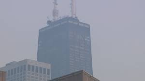
States including Pennsylvania and Massachusetts have issued their own air quality alerts, describing skies that shifted from a milky haze to a deep orange-brown as smoke plumes settled over cities like Boston.
Where to Track the Smoke in Real Time
Rather than relying on how the sky looks outside your window, use dedicated tracking tools that update continuously with satellite and ground-sensor data:
- AirNow.gov — Run by the U.S. EPA, this is the official source for real-time Air Quality Index (AQI) readings by ZIP code across the United States, along with fire and smoke overlay maps.
- IQAir.com — Offers a live global AQI ranking, useful for comparing how your city stacks up against others in real time.
- Canadian Wildland Fire Information System (CWFIS) — The Canadian government’s official map showing the location, size, and containment status of active fires.
- PurpleAir.com — A crowdsourced sensor network that offers hyperlocal, near-real-time readings, often more granular than official government stations.
- NASA FIRMS (Fire Information for Resource Management System) — Satellite-based fire detection, useful for seeing where new fires are igniting before they show up on consumer apps.
- Weather apps (Apple Weather, Google Weather, AccuWeather) — Most now include an AQI widget pulling from the same underlying government data, making it an easy first check each morning.
Bookmarking two or three of these — one official government source and one hyperlocal sensor network — gives the most complete picture, since satellite data and ground sensors can occasionally disagree, especially in areas with sparse monitoring coverage.
(Why This Keeps Happening)
Many of Canada’s largest wildfires are sparked by lightning strikes in remote, heavily forested regions, though human activity — including campfires, vehicles, power lines, and arson — also accounts for a significant share of ignitions. The Canadian government has warned that above-average temperatures are expected through July and August, with elevated fire danger particularly forecast for northern Manitoba, the Hudson Bay region, northern Ontario, and parts of Quebec.
The reason smoke travels so far south into the U.S. comes down to prevailing wind patterns and atmospheric conditions. Once wildfire smoke rises into the upper atmosphere, jet stream winds can carry fine particulate matter — known as PM2.5 — hundreds or even thousands of miles from the original fire, settling over cities that are nowhere near an active blaze. This is why a fire burning in remote northern Ontario can still leave Detroit, Chicago, or New York with some of the worst air quality readings on the planet on a given day.
(When the Risk Is Highest)
Wildfire smoke risk isn’t constant — it fluctuates by time of day, wind direction, and season:
- Peak fire season: Late June through August tends to be the most active stretch for Canadian wildfires, driven by dry vegetation, heat, and lightning activity.
- Early morning and evening: Smoke often settles closer to the ground during cooler, calmer periods, meaning air quality can be worse at dawn and dusk than during peak afternoon heat when the atmosphere is more turbulent and disperses pollutants upward.
- Days after a wind shift: A change in wind direction can rapidly redirect a smoke plume toward a new region within 24 to 48 hours, so even areas with clear skies today can see conditions deteriorate quickly.
- Multi-day stagnant weather patterns: When there’s little wind to disperse smoke, pollution can accumulate over several consecutive days, which is exactly what’s driving the record-breaking readings currently being reported in the Midwest.
Checking your local AQI each morning during fire season — rather than assuming yesterday’s clear skies will continue — is the single most useful habit for staying ahead of sudden spikes.
(How to Read the AQI Scale)
The Air Quality Index runs from 0 to 500, broken into six color-coded categories:
- 0–50 (Green): Good — air quality poses little to no risk.
- 51–100 (Yellow): Moderate — acceptable for most, but sensitive individuals may notice mild effects.
- 101–150 (Orange): Unhealthy for sensitive groups — children, older adults, pregnant people, and those with asthma or heart conditions should limit prolonged outdoor exertion.
- 151–200 (Red): Unhealthy — everyone may begin experiencing health effects; sensitive groups face more serious risk.
- 201–300 (Purple): Very unhealthy — health alert conditions; everyone should reduce outdoor activity.
- 301+ (Maroon): Hazardous — emergency conditions; the entire population is at risk, and outdoor activity should be avoided entirely.
Health officials generally consider AQI levels above 150 dangerous for the general public, not just sensitive groups.
Bachne Ka Tarika (How to Protect Yourself)
1. Stay indoors during peak smoke hours. When AQI crosses into the orange zone or higher, limit time outside, especially strenuous activity like exercise or yard work.
2. Keep windows and doors closed. Seal gaps where possible. If your home has central air conditioning, run it on recirculate mode rather than pulling in outside air.
3. Use a HEPA air purifier. A portable HEPA filter unit in your bedroom or main living space can meaningfully reduce indoor PM2.5 levels, even in a home without central filtration. If a dedicated purifier isn’t available, a simple homemade box-fan-and-filter setup can help in a pinch.
4. Wear a well-fitted N95 or KN95 mask outdoors. Cloth and surgical masks do not filter out fine particulate matter effectively. If you must be outside during high-AQI periods, an N95 provides meaningfully better protection.
5. Avoid adding indoor pollutants. Skip candles, incense, frying food, and vacuuming (unless using a HEPA-filter vacuum) on bad air days, since these can add to indoor particulate levels even with windows closed.
6. Know your personal risk factors. Children, older adults, pregnant individuals, and anyone with asthma, COPD, or heart disease should be especially cautious and consider staying indoors even at moderate AQI levels.
7. Watch for symptoms. Coughing, throat irritation, shortness of breath, chest tightness, or unusual fatigue can signal that smoke exposure is affecting you — these warrant reducing outdoor exposure further or consulting a doctor if symptoms persist.
8. Have a go-to public space if needed. On the worst air days, some cities open designated “clean air shelters” — public libraries or community centers with filtered air — for residents without home air conditioning or purification.
The Bigger Picture
Wildfires are a natural and, in some ways, ecologically necessary part of forest cycles — recycling nutrients into soil and clearing dead vegetation. But as fire seasons grow longer and more intense across Canada, the smoke they produce has increasingly become a recurring public health event for tens of millions of Americans who live nowhere near an active blaze. Checking a reliable air quality map has, for many people, become as routine as checking the weather forecast — and during peak fire season, it’s just as important.